We drove onto the broad drainage of Nemo Canyon looking to visit the Christmas Tree Mine cabin.
I was curious to see if it was still standing. That question was quickly answered.
Although the outhouse was still in operation. Jan noted that it was a two-seater.
Next it was on to Aguereberry Camp.
Pete's camp wasn't in very good shape. Jan noticed that someone had stolen the lucky horseshoe from above the front door of his cabin and in a another building the sheet-rock walls were broken and holed.
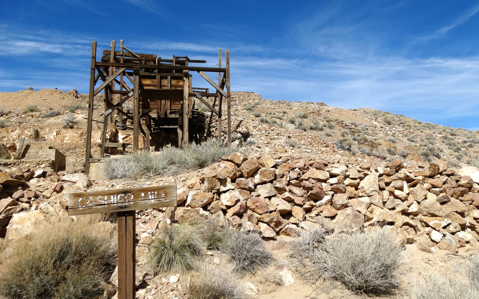
Since we were close by, a walk over to the Cashier Mill seemed in order. Jan led the way taking the high trail.
Jan, Jo Ann and Bosco are somewhere on top of the hill behind the mill. We all noticed that stabilization work had been performed on the mill and asked ourselves why it wasn't done on the Christmas Tree Cabin.
Next we drove to a pull-out on the Emigrant Canyon Road and began a hike to another camp.
Bosco out in front.
Our first view of the camp.
We all dropped our packs and started to look around.
A rare sight in the desert: a vehicle with no bullet holes.
Looked like a post-WWII Pontiac.
The interior of the cabin was spacious with bunk-beds and a separate bathroom with a tub.
Two tanks on the hillside were supplied with water by pipes from a spring about 600 yards up the canyon.
We discovered that the Pontiac had a flat-head straight eight, the most powerful engine Pontiac manufactured until the V-8 was introduced in the early 1950's.
We hiked back to our vehicles and drove North on Emigrant Canyon Road to the access road for Telephone Canyon and the Tucki Mine.
Crossing the broad expanse of Emigrant Wash.
Eventually the route turned South into the canyon.
The upper elevations of the canyon changed dramatically as evening fell. While I was taking this photograph Jo Ann exclaimed to Jan, who was riding with her, "What is a panel truck doing way up this canyon?" Jan informed Jo Ann that the panel truck was actually my truck and camper. Jo Ann replied, "Maybe this canyon should be named Hallucination Canyon."
We set up camp on a saddle at the top of the canyon and prepared dinner as the last rays of the day disappeared into the night sky.
Dawn over Death Valley to the East.
After breakfast we jumped in Jo Ann's Rubicon and drove to the top of the hill in the photo to begin our next hike.
On top of the hill at the wilderness boundary. The road continues but is now closed.
We hiked down the really steep 4x4 road to the flats below where we found this sign.
Two major errors on this sign. Scroll to the bottom of the page to see the errors. Jo Ann and I discussed why the sign was needed in the first place. You can see the cabin about 1000 yards away.
Cabin in sight.
Very yucky interior.
The view from the cabin looking East back toward the sign.
We hiked back to the Jeep, drove down the hill and then East to the Tucki Mine.
The interior of the cabin.
Jo Ann found this inscription on one of the foundations.
Something happened here that I promised not to reveal but it was darn funny. After recovering from the laughter we looked around the area a little more and then drove back to camp.
Jo Ann found this dugout just a few yards from our campsite.
After lunch we began our drive down the canyon back to pavement.
We stopped at the mouth of Telephone Canyon.
And hiked up to Telephone Arch where Bosco and Jan posed for a photo. (Shouldn't it be named Telephone Bridge because it was created by flowing water?)
After the short hike to the arch we returned to the vehicles and continued our drive out of the canyon.
As we approached the mouth of the canyon day was turning to night.
We drove into the sunset leaving Death Valley National Park behind.
Errors on sign: Directions for latitude and longitude are reversed and once that is fixed, the longitude should be West. Should read: 36º28'03" North 117º06'22"West