 Three elk calves stand on the road deciding whether to join the adults who had jogged into the forest seconds before.
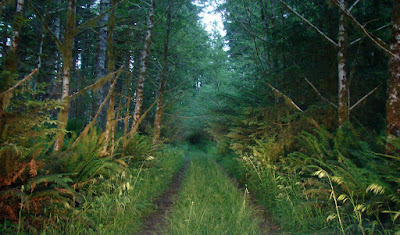
 Driving through the Spruce-Hemlock-Fern Forest at dusk.
Coast Camp 2 - 44°15'15.66"N, 124° 5'38.88"W
This is the day that I decided to ride the 101 as it followed the coast.
I left Jan at camp sipping tea and rode on ahead.
After about 10 miles I had had enough.
Being passed by vehicles when riding on or near the shoulder is something to which I am accustomed. However, on this section of highway "no shoulder" is often the rule, usually on curves with a guard rail giving the rider no escape. Large RV's and tractor trailers are hugging the inside of curves putting themselves just a whisker from the rider.
A tip of the helmet to those who ride the entire coast highway.

View above the camper.

On the beach north of Cape Kiwanda, Haystack Rock in distance.

Coast Camp 3 - 45°21'56.69"N, 123°58'0.97"W
Cape Lookout State Park
Rode about 20 miles around the park and the ride was more pleasant than the 101.

Plaque at Cape Lookout regarding WWII B-17 crash.

FWC and Three Arch Rocks

Sign in Bayocean, near Cape Mears, Oregon.

Jan visited the Tillamook Cheese factory while I took a nap in the camper.
Panorama inside building.

Worlds most photographed shipwreck, the Peter Iredale.
Fort Stevens State Park, WA
Better photo of the shipwreck found here.

Battery Russell, a 10" gun emplacement at Fort Stevens State Park, WA.

More about Battery Russell.
 Approaching the Astoria-Megler Bridge to cross the Columbia River.
Note: Bridge crossings make Jan very uncomfortable.

Getting closer, Jan.

It isn't over yet.
Washington is just a bridge away.


No comments:
Post a Comment