Devil's Gate.
The road to Papoose Flat began here.
One of the many cacti in bloom.
As the road climbed up the ridgeline it became steeper and rockier.
After a couple of tight switchbacks we gained the top of the ridge.
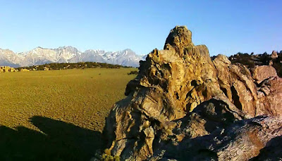
In a few more miles Jan had her first view of Papoose Flat.
We drove East looking for a campsite I had discovered on a previous visit.
Soon we located the arch that marked the location of our campsite.
Jan and Bosco scrambled up to the portal for a photo.
As the shadows grew long we set up camp on Papoose Flat.
On a visit 15 years ago I had remarked to a friend that this would be a nice place to climb. So after dinner I decided to look for evidence of such activity. It only took a couple of minutes to spot a hanger.
Sunset through the portal.
15 second exposure with three seconds of light paint of the foreground.
As the sun rose in the East the moon set in the West.
Bosco can't figure out if the quadcopter is friend or foe.
Scattered clouds formed over the flat.
Later in the day Bosco and I hiked away from camp to circle around some of the "erosional remnants of the Papoose Pluton that now stand as spires and monadnocks." - Esoteric jargon courtesy of AG Sylvester, UC-Santa Barbara.
As the afternoon ended we circled around one of the larger monadnocks and started back to camp.
Obligatory photo of vehicle through arch.
Bosco relaxed beside me
until he heard Jan open a package inside the camper.
Sunset highlighted clouds in the Wave of the Sierra Nevada.
Dawn and a few hours later we packed up camp and drove south.
The road south out of Papoose Flat climbed the ridge ahead.
The only difficult portion of the road was a rocky 100 yard climb.
The traction was good as we drove up the ridge. It was just a matter of finding the right line.
We motored across an unnamed valley.
And then up and over another ridge.
Many wildflowers were still in bloom along the road.
The end of the 4x4 road at Badger Flat.
We drove across Badger Flat and set up camp on the southern shoulder of Mazourka Peak.
Dawn.
Our route down Mazourka Canyon.


Beautiful pictures of the sunset! I wish I could go someday.
ReplyDeleteDid you come across more climbing bolts? Would love to do some sport climbing up there. Thanks for sharing!
ReplyDeleteAlso, do you happen to know the coordinates for that one bolt you posted?
ReplyDelete