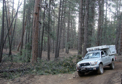
After fueling up in St George I head back into the AZ Strip.
First destination: The Grand Gulch Mine, about 100 miles away.

Upper Pigeon Canyon.

Lower Pigeon Spring

Spring house at Lower Pigeon Spring

Inside the spring house. The water was at least 18" deep.

Exiting Upper Pigeon Canyon onto Grand Gulch Bench.

Mustang Point in the background and water in the foreground.

Headed for the Grand Gulch Mine.

Grand Gulch Mine ruins.

In the early 1900s, the buildings at the Grand Gulch Mine consisted of a three-room bunkhouse made of heavy rock and a house with three main rooms—one tor the office, one for dining, and one for woman's quarters. The main engine at the mine was an old-fashioned one-cylinder, four-cycle Fairbanks-Morse (Cox, 1982). - Quest for the Pillar of Gold

"Othel Milne recalled that around 1917 or 1918 about eighty men and women were working at the mine. The women were cooks and waitresses (Cox, 1982:310). "Mrs. Riding, the two Blair girls, Jane Larson, Mary Lamb, and Will and Lamar Pearce's wives are some that I recall. And I did love Maggie Averett's raisin pies—she was a wonderful cook. There was also the lady from Los Angeles and a few from down on the Muddy [River] in Nevada. Some of the women had small children out there with them." - Quest for the Pillar of Gold

Driving up to the landing strip.

I camped at the southern end of the landing strip and could see what may have been Kingman, AZ to the southwest. Later that night I hit the Hayden Peak (SE of Kingman) repeater on 2 meters.

Same camp 10 hours later.

Wind sock for the landing strip.

More than 50 years ago.
Link to more about the Grand Gulch landing strip.

Aircraft tie down.

An adobe smelter was built to process ore, but it never worked successfully.
- Quest for the Pillar of Gold

In 1978, two large late-1940s ore trucks were still at the mine, with rotted flat tires and only a few missing parts). - Quest for the Pillar of Gold

Two old Euclid dump trucks.
They may be older than 1948.


1948 Euclid 20
From: EquipmentTraderOnline.com

Who was the last person to drive this truck?

Impressive piece of masonry for such a hard scrabble location.

Leaving Grand Gulch Mine.
History of Grand Gulch Trail.

Making the turn for Snap Point and the Savanic MIne.

The beginning of the Savanic Mine/Lower Pigeon Canyon Road. Tassi Ranch is at the other end.

Headed for Snap Point in the distance.

Driving SE on the Snap Point Road starting up Snap Canyon.

Climbing up Snap Canyon to the Shivwits Plateau.

Reached the spot near Salt House Draw that we camped at during our Spring Break trip.

Drove east for about an hour to the Mount Trumbull School House.

The Bar 10 Ranch landing strip in Whitmore Canyon.

Starting the descent into Paw's Pocket.

Stone steps leading down into Paw's Pocket.

Paw's Pocket Cabin

Stove inside of cabin.
Interior of cabin.

Looking down on Whitmore Canyon.

Paw's Pocket Window onto Whitmore Canyon.

Climbing back up the steps.

Driving north from Paw's Pocket back to Whitmore Valley and the Bar 10 Ranch.

The road to the Bar 10.

North of the Bar 10 Ranch turning toward Mount Logan

Climbing up the Mount Logan Road.
Near the summit of Mount Logan I managed to check in with a Kingman, AZ ham club during their 7PM net using the Hayden Peak repeater about 90 miles away.

Descending forest roads on the upper slopes of Mount Logan.

Dusk becomes night as I descend northwest through Potato Valley towards Mount Trumball.
A few minutes after taking this photo I was driving past some cattle sleeping along side the road when a calf spooked. It jumped up and ran across the road in front of my truck. Missed it by inches.Haven't had any thing like that happen since I lived in Wyoming back in the 70's.

Seegmiller Mountain camp and ....

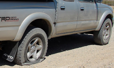
... another flat tire.
Some 'fix a flat,' five minutes on the compressor and its time to head for pavement.

The Big O in Mesquite is open on Tuesdays.
Twenty minutes later the flat is fixed and I am headed for home.


