Use the archive on the right to view older posts.

Monday, January 21, 2013

Salton Sea, East Shore - "squadrons of pelicans flew in formation"

After visiting the seaside town of Bombay Beach we drove along the eastern shore of the Salton Sea to Salt Creek Beach.
 We set up camp at a site near the seashore. Contrary to what we were expecting there was no intense odor at our site.
 Enjoy walking on salt encrusted shorelines? Then the Salton Sea is the place you except for...
the thousands of dessicated Tilapia carcasses. A park ranger told us that fish die offs are a common occurrence at the sea. "The summer sun, paired with the nourishment of fertilizers in the runoff, cues massive blooms of algae that spread shore to shore. When this algae dies, the bacteria that feeds on it consumes what little oxygen there is left in the Sea. Tilapia caught in these miles-wide blooms haven’t the slightest chance of escape." - Wired Magazine
 Jan and I both had to admit that, fish carcasses aside, camping by the Salton Sea was spectacular. Thousands of birds inhabit the area and were in constant motion.
 After sunset squadrons of pelicans flew in formation past our camp.
 We sat outside, ate dinner and watched the show. Evening temperatures were moderate with an overnight low of 48 degrees.
 The light show continued long after we finished dinner.
Mount San Jacinto, 10,834 feet, (San Jacinto Peak) loomed far to the north. The light on the peak's shoulder is the upper station of the Palm Springs Aerial Tramway at an elevation of 8,516 ft. Hiked to the top of San Jacinto in December of 2005. It was windy and cold on the summit.
 Dawn on the shore of the Salton Sea.
 View through our window.
 After a leisurely breakfast we drove north to the Salton Sea State Recreation Area headquarters. The state built an excellent boat ramp and harbor at this location. It was a simple and easy process to launch. We paddled about 1/2 mile off shore and let the wind blow us back to the harbor. Then we paddled south along the shore and drifted back once again. Number of dead fish sighted - one.
After finishing our paddle we used the nearby boat wash to rinse off the kayak/gear and ate lunch while everything dried. After that it was time to pack up and head for home.

Both Jan and I were pleasantly surprised with how much we enjoyed our stay at the Salton Sea and plan to return.

Sunday, January 20, 2013

Red Canyon and the Bradshaw Trail

The plan was to drive a portion of the Bradshaw Trail that I did not cover 12 years ago. Our route took us near Chiriaco Summit on I-10 and the General George S. Patton Memorial Museum. Having driven by the museum on many occasions it was time to visit.
 We examined the exhibits inside the building and the tanks parked outside.
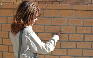
 Jan discovered an upside down memorial brick and we both decided that it probably got more attention than all the rest.
 We passed this sign while driving on the old US 60.
 After reading the sign I paid much closer attention to the condition of the bridges we crossed on our way to the Red Canyon Road.
 We turned south on the Red Canyon Road and shortly after taking this photo a 2012 FWC Finch on a gray 2011 Tacoma pulled up behind us. The owners of this good looking rig were Rick and Alice from San Diego. The four of us talked for a bit, they drove on looking for a place to camp and we continued south.
 Sometimes the road climbed out of the wash.
 Other times the road was in the wash.
 Then the road crossed the bajada on its way south.
 There were a few sections on the road where we had to engage the 4WD.
 Jan felt the need to insert herself into my nifty shadow photo.
 As sunset neared we found ourselves above Red Canyon driving the ridges down to Salt Creek Wash.
 The Chuckwalla Mountains to the east captured the last rays of the setting sun.
 Jan spotted our next destination, the Salton Sea, in the distance to the west.
 We reached Salt Creek Wash after sunset and set up camp near the mouth of Red Canyon.
 The rising sun casts a golden glow on the cliffs above our Bradshaw Trail camp.
 After breakfast I noticed a couple of flags on a cliff high above our camp.
 
 The Stars and Stripes were only attached to the pole at one point and needed some repair. I decided to climb up and fix the problem. My first route to the top began to require climbing skills that I no longer possessed. Soon my addled brain began to realize that there must be an easier route. After scouting around I found another route that wasn't much more than a scrambling hike.
 Jan stayed below by the camper to read in the warm sun and take the previous photo.
 A little wrenching unmounted the pole so I could reattach the flag. About five minutes later Old Glory once again flew proudly above the junction of Salt Creek Wash and Red Canyon.
 We drove up the wash to investigate the narrows of Red Canyon.
Looking back at the mouth of Red Canyon. Flags flying on the bluff to the right.
 I found a crushed granola bar in the middle of the wash, opened the package and poured the broken pieces in front of a gopher hole. Gophers for generations to come will chatter about the crunchy sweet manna that appeared early one afternoon in January of 2013.
Our drive of the Bradshaw Trail traversed the north boundary of the Chocolate Mountain Aerial Gunnery Range (CMAGR). Jan heard explosions during the night at our last camp.
 Crossing under the Eagle Mountain Rail Road.
 Crossing over the Eagle Mountain Rail Road.
Soon the Coachella Canal came into view.
 Near the canal a courteous Border Patrol agent talked with us for a few minutes. We drove on and finally reached pavement at Hot Mineral Spa Road.

Thursday, January 3, 2013

Stonewall Falls, Nevada - "the air was still and the snow crunchy"

We drove east toward the Nevada Test and Training Range, formerly the Nellis Air Force Range, on the Stonewall Flat road.
Jan opened the gate so we could enter the range.
The sign explained that we could proceed to Stonewall Falls if we stayed on the road.
Our destination was straight ahead.
Once we entered the shadow of the mountain the temperature dropped 10 degrees.
We set up camp about 100 yards from the falls to give animals a clear path to this source of water.
Jets flew past our camp to the west on their way to and from Las Vegas.
 Sunset and it was already 27 degrees The air was still and the snow crunchy.
A closer look at the frozen falls in the morning light.
Frozen bananas for breakfast?
The falls remain in shadow all day. As the snow line shows the sun never gets close to the falls.
As we drove west to US 95 the sparkle of ice caught our attention. Jan investigated.
Stonewall Mountains beyond an icy pond.
We drove west on Nevada 266. Our plan was to drive down Tule Canyon into DVNP on through Crater and then camp at Eureka Dunes.
This water jug made us change our plans. Our water tank in the camper was empty because we had drained it in preparation for our two night stay in Tonopah. (The overnight lows were 12 degrees.) I forgot to fill the tank before leaving town. We used our emergency water while camping at Stonewall Falls but did not think about getting water until reaching Tule Canyon Road. We did not have enough fuel to backtrack for water. (The lone gas station in Goldfield is no longer open. The nearest gas is now Tonopah or Beatty) I did not feel comfortable driving through a remote section of DV with only 1.5 gallons of water. We decided to head for home.
White Mountain Peak rises above our road as we near Oasis. Hiked to its summit in 2000.