After fueling in Baker we drove North on the 127 and then West on the Harry Wade Road.
The drive into the Owlshead Mountains always takes longer than expected. This time was no different.
Fort Irwin to the South.
At the Fort Irwin entrance we turned right and entered Death Valley National Park. The Owlshead Range was annexed when the monument became a national park in 1994.
This is my fifth trip into this area and have yet to encounter another vehicle.
We set up camp alongside the road near the closed 4x4 road that would be our route the next day.
Dawn.
Our objective was about four miles to the South. The road was closed in 1994 when the area was declared wilderness.
As we were walking along the old jeep road Jo Ann spotted this .50 caliber shell casing. Interestingly she found it again on our return.
After 1 1/2 miles we cached water.
The jeep road disappeared where it entered the wash.
But there were many well trod burro trails to use.
While we stopped for a break Bosco, sans backpack, remained alert watching for burros.
After a few minutes he relaxed in resignation that burro chasing was not permitted.
Looking back on our route. Several times during our hike I lamented the fact that years ago a friend had suggested that we drive in and visit this cabin. Assuming that there would be many opportunities in the future I declined. Now I trudged up a canyon that we could have driven just a few decades before.
In the upper reaches of the canyon we found the first relic of habitation.
Soon we sighted the cabin.
Sad to see the cabin in such poor condition.
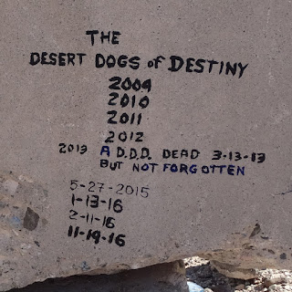
The log book told of a snug, well kept dwelling that was used often for decades.
Last entry in log book.
Interesting account of a visit to the cabin in 1979 can be found
here.
The condition of the cabin deteriorated after wilderness designation because equipment and materials could no longer be transported by vehicles.
The hill behind the cabin is encroaching on the back wall.
After reading all the entries in the log book and checking on the condition of the spring, it was time to begin our hike back to camp. (The spring was a small puddle.)
There were many burros in the area and their trails crisscrossed all the hillsides.
Lost Lake in the distance behind our camp.
I dined on Thanksgiving leftovers while we looked for meteors in the night sky.
Sunrise.
Our plan had originally been to walk out to the Lost Lake playa on the
second day but my exploring spirit was dampened by the thought of
walking eight miles on a road that I could have driven 22 years ago.
The only section on the return route that might require 4x4.
Sections of the road are paved. Probably done when the microwave relay tower at the end of the road was in service.
We made a brief stop at Owl Hole Springs and discovered that the palm tree had died.
Road conditions improved after we passed the Fort Irwin gate. Kingston Peak in the distance.
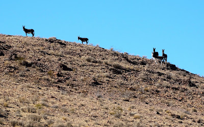
More burros were sighted.
Hard to believe but in Death Valley National Park a person can ask their passenger if they want to drive over to the river.
No water flowing in the Amargosa River but on August 16, 1983 the flow was 10,600 cubic feet per second and must have been something to see. -
wdr.water.usgs.gov
We continued on to Baker and then drove West on I-15 past Cave Mountain. Whenever I drive by this peak I cast it a friendly wave. Jan, Jo Ann and I were on its summit 14 years ago.
Storm clouds were forming as we approached Barstow.


