We drove through Searles Valley on our way to Mahogany Flat Campground in DVNP.
Passing over Slate Range Crossing. Looking down into the Panamint Valley with the Panamint Mountains in the distance.
The wind was really gusting as we drove north along the valley.
Panorama of the valley.
The wind was creating a small dust storm ahead.
Soon we reached the turn for Wildrose Canyon and a road closed sign.
**Drove this road in 2/2016 and discovered road crews working to repair road. ON A WEEKEND! The Eastern end of the closure now sports Road Closed signs at the junction with Emigrant Canyon Road rather than West of Wildrose Station at the DVNP boundary. There is a gate at the Emigrant intersection that may be locked when crews are not working.**
We drove on. Here are a few photos of the damaged sections of Wildrose Road for anyone who might be curious about the condition of the road.
Second section. Wildrose Road was damaged by a
flash flood last summer.
Telescope Peak, the destination of the friends we were meeting at Mahogany Flat.
Last damaged section. At no time was the pavement completely destroyed. If the road wasn't paved a grader crew could probably repair it in a couple of days.
Entering Wildrose Canyon.
One winter in the 1980's I drove through this spot and the ice was six inches deep and 40 yards long.
At Rattlesnake Gulch where Wildrose joined the Emigrant Canyon Road good pavement began and continued until a mile from the kilns.
I had photographed these kilns many times in the past and told myself that I did not have to again.
But somehow these historical conical masonry structures lured me in for more photographs.
Jan at the door of a kiln.
After the kilns the road gets steeper and a little rough. This was the first time in four trips to Mahogany that I did not have to engage the 4WD. Usually there is a short curve near the top of the road that needs 4WD but this year the road was very tame.
We arrived at our 8,000 feet elevation Death Valley destination at about 7:30. After Jan told people at work that she was headed for Death Valley in June they were concerned about the heat. She told them that the daytime temperatures would be in the high 70's and the nighttime lows in the 40's. They were surprised until she explained the wonderful physics of elevation and temperature.
Jan was pleased to see that the campground had a toilet.
At the end of the campground we found our friends who had arrived a few hours earlier.
Photo Credit: Mark T
Laura was photographed in a tree reading, "How to Read Literature Like a Professor." A book on her school's summer reading list.
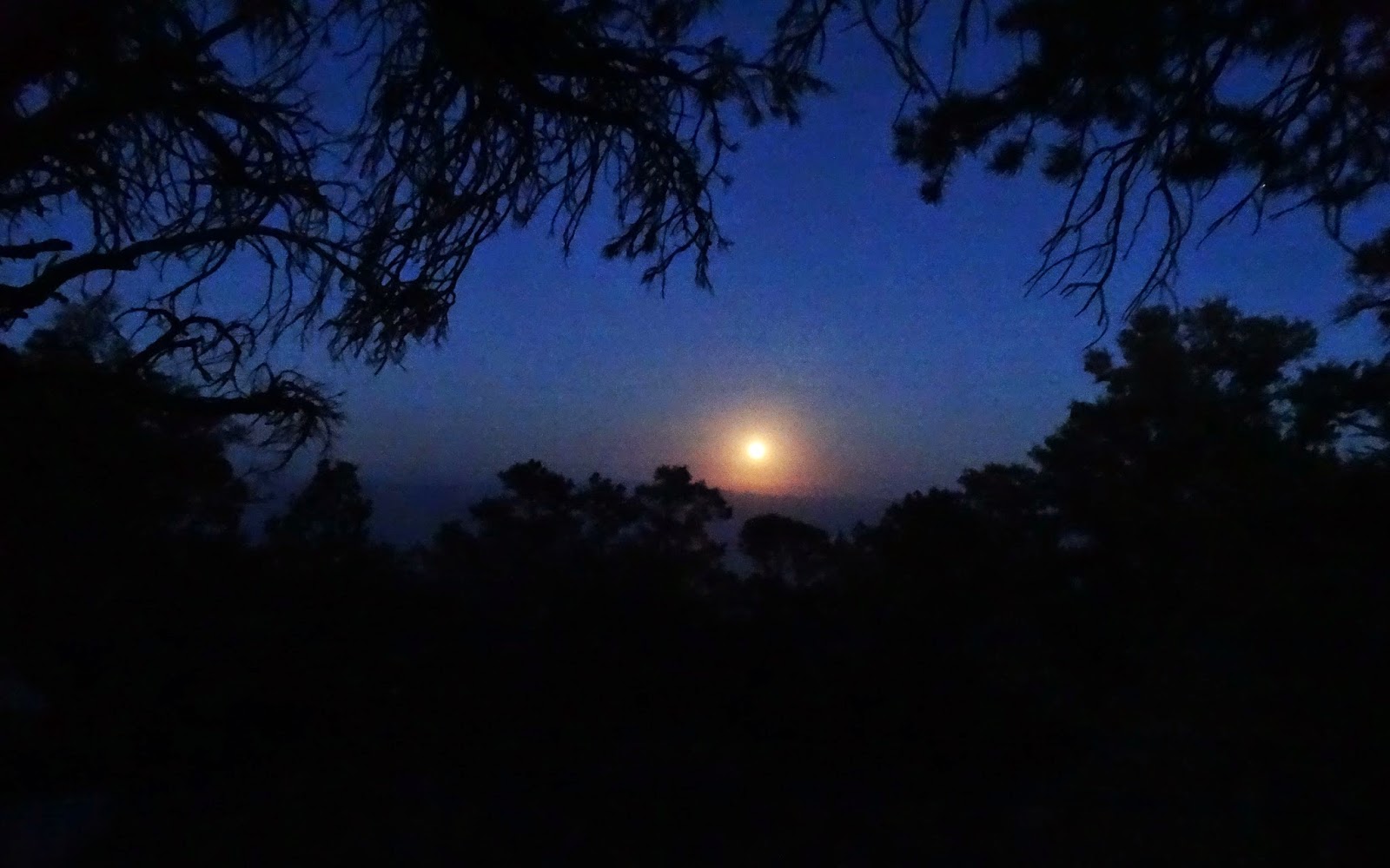
After dinner the moon began to rise over the horizon.
The almost full moon provided bright conditions for a 25 second exposure of our camp.
At 8 A.M. the next morning I photographed the Telescope Peak hikers at the trailhead. Laura, Mark, Travis, Danielle, Lucas, and Mark.
Soon after this photograph the hikers pulled away from the slow hiking older guy.
I pressed on to my objective, Arcane Meadow, as they disappeared from view.
Wild flowers alongside the trail gave me an excuse to stop and take a photo.
Arcane Meadow. It was my destination because I saw no need to hike to the summit of Telescope again. Actually, I wondered why I felt the need to hike to Arcane Meadow again.
I found a comfortable rock to rest against and sat down to read a few chapters of "Blood and Thunder" by Hampton Sides. A more nuanced hiker might have brought William Manly's
"The Death Valley in '49" to read while relaxing against a rock on Arcane Meadow between Rodgers and Bennett Peaks. It does seem odd that Manly's namesake peak, hiked it in 2002, is miles to the south and thousands of feet shorter than Arcane, Rodgers and Bennett. Although it is closer to his escape route.
After an hour I started back to camp and realized that a better plan would have been to hike up to Arcane later in the day and meet the hikers on their return.
The trees and bushes were full of cicadas, Latin for "tree crickets." Some were still nymphs but most flying around as imagos.
Many cacti were blooming in the Panamint Mountains.
Jan and I relaxed in camp while the others were reaching the summit of Telescope Peak.
Photo Credit: Mark T
Laura and Lucas were the first to reach the summit.
They had completed a 20 mountain challenge.
Photo Credit: Mark T
Soon everyone arrived. Mark and Danielle, father and mother of, Lucas and Travis.
Photo Credit: Mark T
Laura with her father Mark.
Photo Credit: Mark T
I asked Mark to take a photograph looking south. Twelve years ago I was planning a traverse of the Panamint Range from Mahogany, across Telescope, Sentinel and Porter Peaks, to Redlands Canyon. Should have done it then because I don't see it happening now. Darn, because Sentinel Peak is the only summit in the range that I haven't reached. The summit register on Porter had a couple of entries by crews on helicopters from NAWS China Lake.
After photographs on the summit of Telescope the hikers began their seven mile return to camp. Most of the hikers also claimed the summits of Rogers and Bennett. Their total time on the trail was 6.5 hours. Excellent time for all three summits. Much better than mine 20 years ago.
Second night at Mahogany Flat.
Morning at Mahogany and time to start breaking camp.
Mark, Danielle, Lucas and Travis were the first to leave. They were on their way to Badwater.
Next Mark and Laura depart headed for Skidoo and Aguereberry Point.
Jan and I were last to leave and we were headed for home.
We made a brief stop at the remains of Wildrose Station.
The oleanders were in bloom.
All that remains of Wildrose Station are foundations and rock walls.
Wildrose Station in 1933. Photo from my copy of
"The Explorer's Guide to Death Valley National Park" - T. Scott Bryan, Betty Tucker-Bryan
Would have liked to visited Wildrose Station when it was open.
What happened to the station can be found here.
Driving out of Wildrose Canyon with the Panamint Valley and pavement ahead.
One last look at Telescope Peak on the right. Rogers and Bennett Peaks on the left.