Use the archive on the right to view older posts.

Sunday, April 29, 2012

Trona Pinnacles

Passing a familiar landmark.
Entering the Trona Pinnacles National Natural Landmark from the southeast. It has been 15 years since my last visit to these unusual formations.
 Clouds darken the sky as a weather front moves into the area.
 Crossing the soft sand of Teagle Wash with our camp site in the distance.
Our camp east of Teagle Wash provided excellent vistas of the area.
The clouds clear and towers to the north are silhouetted by the sky.
A formation near our camp.
Late in the afternoon, off in the distance, a train rumbled by on the Trona Railway headed for Searles Station. What happened to the red and white locomotives?
Dawn breaks over a group of pinnacles to the south.
It rained several times during the night, sometimes fairly hard. The most interesting event of the evening occurred around 9:30 when a helicopter flew around the area lighting up the pinnacles with a search light. 
 View from our camp looking west.
Looking north from our camp.
Sighted a V-22 Osprey headed west toward NAWS China Lake.
The Searles Valley Minerals plant, formerly North American Chemical Company, formerly, Kerr-McGee, formerly American Potash and Chemical, and originally the American Trona Corporation. The town of Trona was built to support the facility.
 View of another formation.
The pinnacles were registered in 1968 as a National Natural Landmark.
The restroom is a new addition since my last visit.
Driving to another camp site. A site that is more accessible because we were expecting company of the 2WD kind.
Sunrise at Camp Two.
We spent a pleasant evening sitting around a campfire, under a clear sky filled with sparkling stars.
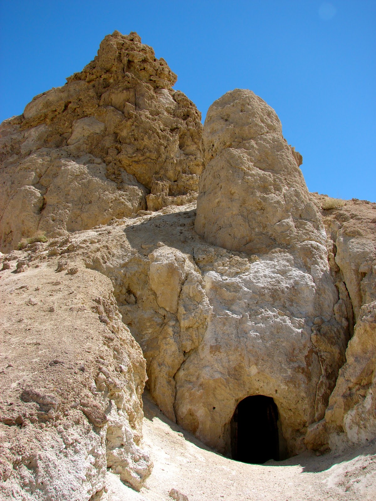
A portal to the Planet of the Apes perhaps?
 A closer look inside revealed some odd looking creatures.
Our camp, from the pinnacles.
 The Trona Railway looking south.
Last crossing before regaining the pavement.


Thursday, April 12, 2012

Turtle Mountains

 We drove east across Ward Valley headed toward the Turtle Mountains in the distance. Gray skies make for cooler temperatures but poor photos.
 Driving on desert pavement as we enter the Turtle Mountains.
 Looking back at the Old Woman Mountains to the west.
 In three days of travel we only encountered people twice.
This mailbox is a way-point that marks our turn south.
The road gets a little rougher.
Very photogenic mountain range.
One of several picnic/camp sites built along the roads in the area. These shelters were built to last. At first glance the structures appeared to be wood but a closer inspection revealed that they are welded steel.
Next stop the Lost Arch Inn.
Not much remains of Charley Brown's cabin.
 An apparition appeared in the window. Charley Brown's sister perhaps.
Near cabin there were several old cars. This is the dashboard of one of them.
The grill of another.
Leaving the Lost Arch Inn.
We plan to drive south toward Carson's Wells and then southeast along the flank of the Turtles.
Looking to the south.
Looking south and in this view I notice a dent in the rear bumper. That dent was made seven years ago when we drove to the Doll House in the Maze District of Canyonlands National Park. If you want remote, then that is the place to go. We were out there for four days and encountered just one other person. The road to the Doll House is not as difficult as the rangers make it sound.
Late afternoon and the shadows are getting longer.
Crossing what could be called Coffin Springs Wash and looking to find a campsite before dark.
 Dusk at our Turtle Mountain camp.
 The next morning we continue south through a few fairly steep wash crossings.
Approaching the end of the road.
Jan noticed this tiny baby barrel cactus.
Two arches above a canyon that I hiked into after reaching the end of the road.
Found this very orange rock while hiking down a small canyon.
Would like to be here when the water was flowing down this stream.
Old and not so old relics from the past.
How many years have gone by since this can was opened?
We begin our drive back to the Lost Arch Inn.
Retracing our route through the steep wash crossings.

Hard to leave such a picturesque landscape.
A barrel cactus with a view.
The steepest wash climb is about a 1/4 mile from the Carson's Wells trailhead.
Jan stands next to a large ocotillo that Jo Ann spotted about 100 feet from the road.
View from inside the stems.
The ocotillo standing alone in the wash.
A cactus between a rock and a rock.
Leaving the Turtle Mountains and driving the long, dusty, washboard road to US 95.
Gasoline prices in Needles.