We departed Tonopah and drove about 40 miles east on US 6 to our first stop, Warm Springs.
We hiked about two hundred yards up to the hot springs.
Closer look at Warm Springs.
The water flows down a ditch to the buildings.
Some of the water is diverted into the pool.
This photo of the pool is from a spot that is probably used by everyone who visits the site. The fence has been pried apart just enough to take an unimpeded shot.
On the other side of the highway a cow gives me a curious look when I interrupt its solitude.
A sign for Nevada 375, the Extraterrestrial Highway, beckons us to turn south but we are headed east for Tybo.
The road to Tybo passes through a small government airfield named Basecamp.
One of the buildings still standing i
n Tybo, Trowbridge's General Store. Several of the structures in the town are being used as residences.
Headframe and portal for the Two-G mine.
More information about Tybo here.
Farther up the canyon is a water tank manufactured by
J.F. Holbrook of Los Angeles.
We drove up Tybo Canyon to another set of charcoal kilns,
The keystone in the door arch is missing.
The kilns at Tybo are made out of local rocks rather than bricks like the structures in Kiln Canyon.
Found this weathered bastard flat file in the middle of the road. It is now on display on a boulder a few feet from the road.
Spotted this cool formation of folded rocks while driving south out of Tybo.
Still haven't figured out what to make of this pile of debris.
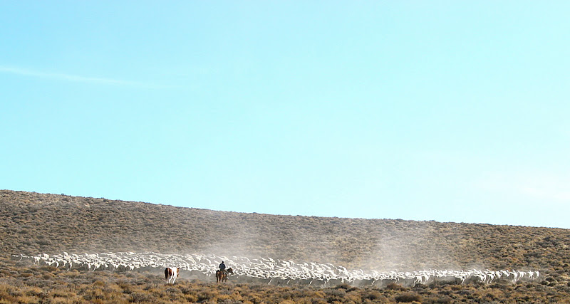
We were on our way to Lunar Crater. The cattle were on their way to another location.
Easy Chair Crater.
We arrived at Lunar Crater about 30 minutes before sunset and searched for a campsite.
Sunrise at Lunar Crater.
More on the Lunar Crater volcanic field here.
The area around Lunar Crater was used by
NASA to train Apollo astronauts. Astronauts Eugene Cernan (right) and Harrison Schmit.
40 years later Jan stands in the same spot as Cernan.
The bottom of this maar is 400 feet below the rim. We decided to park parallel to the crater to avoid having nightmares about rolling into the abyss.
The next morning I walked to the summit of North Kidney Butte.
Many commercial jets fly over this portion of Nevada because of the Flight Restriction Zone over the Nevada Test and Training Range.
Approaching the Faultless nuclear test site.
More about Faultless here.
The ground zero plug.
Video of the test here.
Unnerving to think that a few thousand feet below this plug is gigantic cavity filled with radioactive sludge.
I was curious about the top of the plug.
Plenty of warning signs around the site. All the signs warn of petroleum impacted soil. Not a single sign mentions radioactivity.
Time to leave Faultless before something odd happens.
Frozen Moore's Station Creek.
We visited the petroglyphs near Moore's Station.
We drove on to Pritchard's Station after stopping at Moore's Station. Moore's Station looked very interesting but was fenced off and hidden behind trees. Jan spotted this balanced rock about two miles from Pritchard's Station.
Pritchard's Station. It was active between the 1870s and 1880s on the old Belmont-Tybo-Eureka stage line.
Sunset on the Little Smokey Valley a few miles south of Summit Station.
We were driving an old road west of Red Ring Mountain looking for a place to camp when Jan commented that, "it doesn't look like anyone has driven this road is quite a while." Five minutes later we discovered why. The road was blocked by a landslide. I scouted the area and found a way into a nearby wash.
We engaged the 4WD, drove into the wash, followed it for about 50 yards and regained the road.
Dawn at our west of Red Ring Mountain camp.
A mile from Squaw Wells we saw the first tire tracks.
Exiting Jumbled Rock Gulch.
After exiting Jumbled Rock Gulch we drove to Morey.
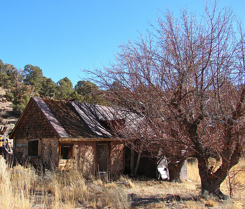
This cabin was interesting because of what was on the wall of one room.
Two walls were covered with old newspapers and photos.
Looks like Lillie Langtry.
Esther Mitchell murdered her brother in 1906.
A few miles from Morey there is a drill hole for another test site. We drove back to US 6 and then south to Little Lunar Cuesta.
As we approached the cuesta I noticed that we were being watched from above. Then I noticed the moon above Little Lunar Cuesta.
I hiked to the top of Little Lunar Cuesta because it looked so cool. My big horn buddy had left the summit.
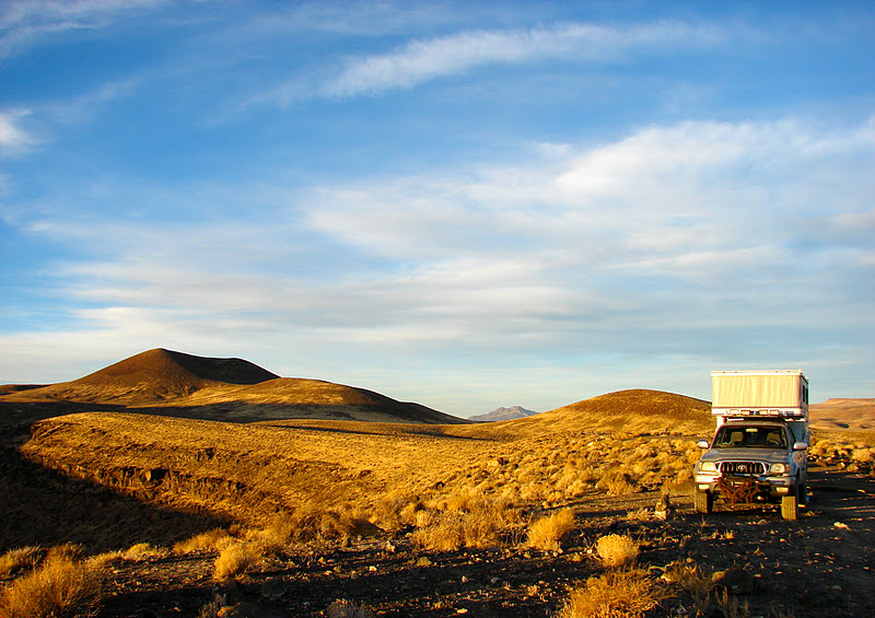
Back at US 6 the fuel gauge read empty. While we were fueling up a Four Wheel Camper on what we think was a green truck drove by on US 6 headed west. We wish they would have stopped to say hello. You don't see many vehicles in this part of Nevada, let alone another FWC.
Near Lunar Crater.
We camped at Lunar Crater for a second night.
Dawn at Lunar Crater.
Tonopah just a few miles down the road.
Another night at the Mizpah Hotel.