We drove East from Baker.
Exited I-15 at Halloran Summit where our route first took us East and then South. Clark Mountain beneath the clouds.
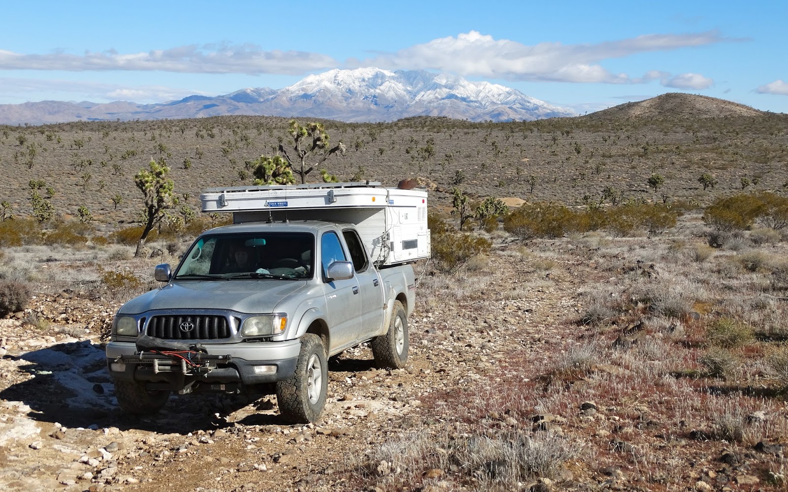
Eventually our route turned East as the road became rougher.
Then we entered a Joshua Tree forest.
And arrived at our first stop, The Sawtooth. Some call this formation the Shaman's Eye but that is probably a bit of hyperbole.
Hard to accomplish in January but during December the sun will set directly behind the "eye" and shoot a beam of light on the terrain north of the formation. We watched it happen ten years ago.
We continued West chasing the sunset.
The last beams of daylight were turning the landscape orange as we set up camp.
The air temperature dropped quickly after sunset.
Our Four Wheel Camper kept us snug and warm as we prepared dinner.
A frosty dawn in the Mojave Preserve.
And it actually was frosty.
Our next stop was quite a disappointment. This road, now closed, was once a route to access Cow Cove on the plateau above. It was a very cool route that passed by a few old mines and campsites before climbing up a road through the high volcanic buttress. Cow Cove has other items of interest.
Instead of driving to Cow Cove we turned North and drove back to the I-15.
Exited at Halloran Summit and crossed the freeway.
Found a very chic art piece by "Punk Me Tender" North of the interstate.
Jan looking toward Clark Mountain framed by a window at the same location.
We drove North.
And then East up onto a plateau toward Solomon's Knob. Five minutes before this photo was taken Bosco could barely contain himself when a small herd of cattle crossed the road in front of the truck.
Jan disposed of a Mylar "O" she found wrapped around a bush. The wind was gusting as she attempted to show me the shape of the balloon.
High on the plateau we reached the end on the road where Bosco and I started for the peak.
After about 30 minutes we gained the summit of Solomon's Knob.
The most interesting entry in the register.
Panorama from the summit.
Found a small patch of standing water on the hike back to the truck.
We drove a rocky route off the plateau looking for a campsite.
The shadows of evening were creeping toward Clark Mountain as we set up camp.
We ate dinner watching the sun set.
Orion over our camp.
Panorama of a cloudy dawn.
Far to the East we could see snow covered Potosi Mountain where TWA Flight 3 crashed in 1942 killing actress Carole Lombard and 21 other passengers and crew.
One last look at Solomon's Knob.
Driving down into the canyon headed for our next destination.
Sighted the a mine above the road and stopped to investigate.
Forgot my headlamp so I did not venture inside.
Bosco is ready to go back to the truck.
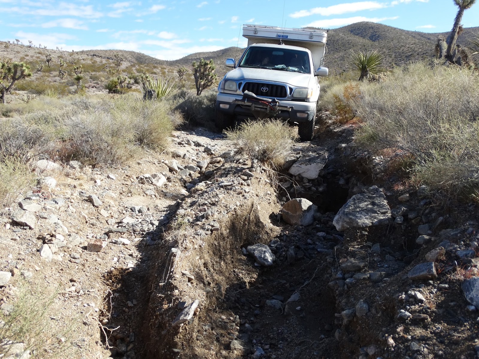
The road became very rutted. My hike was going to begin here.
Bosco and I slowly hiked higher across the rocky terrain.
Found a claim marker.
After about 45 minutes of hiking we reached our objective.
Bosco photobombing my photograph of air beacon Solomon
About 30 minutes later Jan arrived in the canyon below.
We hiked down to where Jan was parked and after we closed all the doors on the truck were on our way home.