Use the archive on the right to view older posts.

Wednesday, June 29, 2011

Near Montgomery Pass - "doesn't seemed to get much traffic"

 Western boundary of China Lake NAWS.
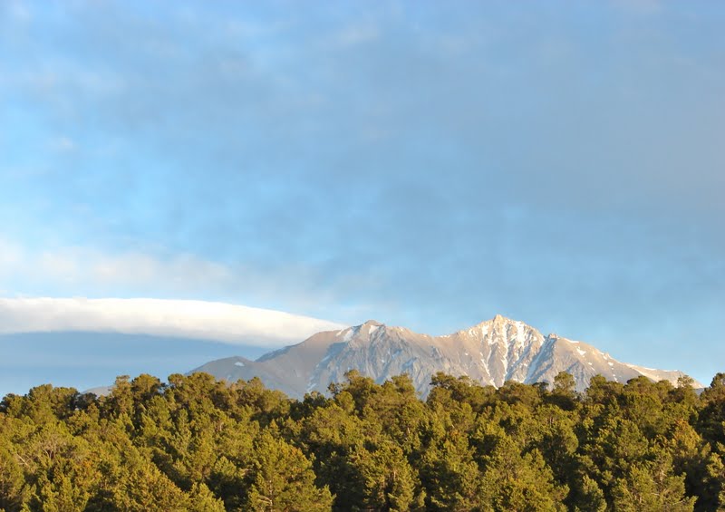
 Dawn at Cactus Flat Camp.
 Looking west.
Old Montgomery Pass Motel
 Driving to Mustang Point, Sugarloaf in background.
 Mustang Point camp, with Boundary Peak to the southwest.
 Snow gauge near Sagebrush Flat.
 Sugarloaf Canyon doesn't seemed to get much traffic.
 Close call in Sugarloaf Canyon. I agree with Jan, when after seeing this photograph, she said, "it doesn't really show how close it was."
 After making our way back to US 6 we decided to try our luck on the north side of Montgomery Pass. Jan has just finished clearing a tree from the trail and strikes a rugged pose.
 We found this Oldsmobile trunk lid alongside the road and wondered how it got to such a remote location.
 One mile later the mystery was solved.
Tree number two.
 Jan cleared it.
 Number three.
 The tree succumbs to Jan's mighty saw.
 Five trees were cleared from the road to Sagehen Spring.
 Cloud bank behind Boundary and Montgomery Peaks.
 Sagehen Spring.
 Range camp near Sagehen Spring.
 Truman Meadow Camp.
 Leaving Truman Meadow, Montgomery Peak in distance.
 The road down Truman Canyon out to US 6 is a rocky, bone jarring track that we never need to drive again.
The Truman Canyon road is rocky until the very end but the views are outstanding.

Sunday, June 12, 2011

Carrizo and La Panza - "looking for a rattlesnake lunch"

 Left Bakersfield after paying my respects to an old friend. Drove west to the Carrizo Plain NM to ride the bike on some the old roads that crisscross this unique valley.
 Soda Lake looking north.
 Walked out on the lake bed and found it much softer/fluffier than the Badwater Playa in DVNP.
 Some water remains in the southern lake. Caliente Mountain in distance.
 Drove on to the La Panza Range in the Los Padres NF. Spotted this building when passing through the same named ghost town on the way to La Panza Summit.
 Water still flowing down Navajo Creek in June.
Navajo Camp to the right, across the stream and up the hill.
 Dusk at Navajo Camp. Only one campsite at this location. Two if you count the small site 60 feet from the parking lot.
 Nearby is a spring fed water trough.
 Constructed 8-25-1948.
 Water striders doing the impossible.
 Early in the afternoon a hungry California King Snake slithered through camp looking for a rattlesnake lunch.
 Dawn at Navajo Camp. Camped here for two nights relaxing, mounting the new weather station, listening to Sirius Radio and reading a couple of books. Not much traffic on the road below camp. (Three cars and seven motorcycles in 48 hours.)
Drove to a nearby mountain top.
 Noticed this working weather station.
 Looks like there might be a few dead cells in this battery.
Yikes, a UFO hovers over a ridge behind the truck.
 
FAA facility.
Or maybe satellite television/internet for the Four Wheel Camper.
 Turkey vultures soared on thermals over the summit.
The oldest building on the mountain.
 The route down the mountain.
The roller coaster road continued. Drove to isolated Friis Camp and while checking the bike tie downs watched a swarm of bees fly across the road. Thousands of bees in a 30 foot high whirlwind of stingers.
Near the San Andreas Fault.

Monday, June 6, 2011

Along the Sespe

We drove north from Ojai to Rose Valley.
Our first hike was to the Piedra Blanca.  In the parking lot Ben and I discussed the "Ten Essentials."
 Ben at the crossing the first branch of Sespe Creek.
Crossing the second branch.
The sign points the way.
Entering the formation.
 We wandered around Piedra Blanca for about 90 minutes
encountering odd looking formations
and human artifacts.
 Elephant Rock.
 
As we were hiking back down to the Sespe a C-130 flew through the valley.
 Looking west as we cross the Sespe, return to the truck and head for camp.
 Dusk at Middle Lion Camp.
It's either steam or odor rising from Ben's socks in the morning sun.
 Dawn at Middle Lion Camp.
 On day two Ben tries a different approach to crossing Sespe Creek.
 Hiking east.
 We were eastbound he was westbound.
We hiked 4.5 miles to reach this location where a heartbreaking tragedy occurred in 1969.
 We encountered several pack trains on the trail.
 Some flowers were
 still in bloom.
 One more creek crossing and we are back at the truck.
 Waiting to take us home.