We crossed I-15 and drove north toward the large dike of granodiorite* that forms the dark stripe across a ridge of limestone on the southern slopes of Alvord Mountain.
*The
Rosetta Stone was carved out of granodiorite.
We skirted around the southern flanks of Alvord Mountain headed east toward Spanish Canyon.
Driving the sandy wash of Spanish Canyon toward an old zeolite claim where we parked and started hiking to the summit of Alvord Mountain.
After about 20 minutes of hiking we looked back at our camp.
We reached the summit of Alvord Mountain just before sunset.
Reading the summit register we discovered that few people visit this peak.
Including our visit, only seven people on the summit in three years.
Eighty miles to the north, snow covered Telescope Peak stood gleaming on the horizon. Porter Peak on the left/west, Jo Ann and I stood on the top of it in December of 2001. It was "cut to the bone" cold and windy on that summit 12 years ago but there was very little snow. The day after Porter we hiked over to Happy Canyon and visited
Jim and Norma Weston who had been living in their remote cabin for 30 years.
The sun began to set behind Calico Peak as we left the summit. Pools of water could be seen reflecting on the surface of the Coyote Lake playa.
On our descent I asked Jo Ann which route she would prefer, following a ridge down to our camp or descending a ravine. She chose the latter and I jokingly said, "Hope we don't run into a high dry waterfall that locks us out." In the photo above, Jo Ann is laughing as we climb down a five foot obstacle with both of us hoping that this would be the largest on our route.
Twenty minutes later our optimism turned to disappointment when the trail ahead dropped sharply into a deep pit of darkness, a sixteen foot dry waterfall blocked our path.
Jo Ann near the bottom of the falls.
A moment later I took a flash photograph and need to say that, we both would have liked for the falls to have been lit like this for about five minutes. We also would have liked to have had the 50 feet of accessory cord that Jo Ann normally carried.
Jo Ann's GPS led us through the darkness of a moonless night to our isolated camp. We set up chairs, prepared meals and then ate dinner watching the Milky Way move across the sky punctuated by an occasional streak of a shooting star.
Dawn at our Spanish Canyon camp.

After a leisurely breakfast we hiked south exploring several canyons.
Jo Ann climbing out of a dead end.
We circled back to camp, ate lunch and then hiked north on another reconnoiter.
Looking south toward our camp.
The sun was setting when we reached our turn-around point.
We reversed course 180º and hiked south through another ravine.
One last dry waterfall to be negotiated.
We returned to camp about 90 minutes after sunset where we once again enjoyed dinner beneath the moonless sky and sparkling stars.
Another dawn near Spanish Canyon.
One last look at Alvord Mountain as we broke camp and prepared to drive north and then west to circumnavigate this small range.
On our way back to Spanish Canyon.
Exploring one of several BLM OHV routes.
This route ended just before this formation.
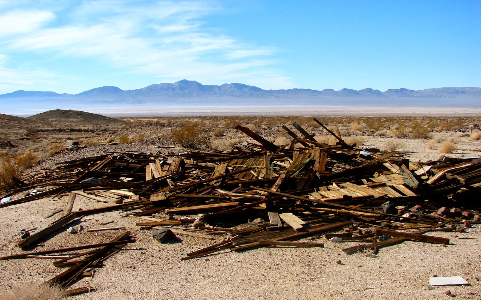
This part of the Alvord Mountain area contained very few artifacts from mining days, although we did pick up three Mylar balloons.
Driving on the road that will lead us to the west side of the range.
Climbing the only steep section of the road. Curiously, this little climb was only a 100 yards from our turn-around point the day before.
After driving through a break in the northwest flank of Alvord Mountain we reached a broad wash.
Headed west toward Coyote Lake.
There were several mine sites on our topographical maps that we visited. The residents of this cabin had an awesome view of Coyote Lake and Calico Peak.
We drove on.
The map showed a mine camp at the end of this steep rocky road. That was all the encouragement the two of us needed.
We didn't find much to warrant the drive except a good place to eat lunch.
After lunch we drove an easier road to another mine.
We found a closed adit and the remains of a camp.
Following an old coyote track we drove West out of the mountains.
In a few miles we reached, what I am sure has another name, but we call it the Fort Irwin Tank Road. This road must have been a mess 36 hours earlier.
The road got wetter and the ruts deeper with every mile we drove. I was really glad that we stayed an extra day to hike because we might not have made it through 24 hours earlier.
After about six miles we reached a transmission line road with a better surface and drove toward pavement.
Interstate 15 with its smooth, dry surface was nearby and it was time for us to head for home.