After our journey around Mount Shasta we drove south to Shasta Lake and set up camp on the north shore of the Sacramento River Arm at Beehive Camp.
Sunset at Shasta Lake.
The location of our camp. Conditions were not as damp as they appear because the lake was not at full pool.
The emerald blue waters of Shasta Lake and a small campfire made a relaxing scene.
We didn't have any wood but a blazing fire was provided by my iPad. The app even supplied the crackling sounds of wood burning but without the smoke. I downloaded the app to use as a joke on this trip but found it kind of cool and might actually use it again.
Dawn at our Shasta Lake camp.
We drove into the town of Shasta Lake for breakfast and then decided to visit the Shasta Dam.
This photo was hanging above the water fountain near the restrooms at the visitor center.
After watching a movie in the theater we walked across the dam. Leaving Shasta Dam we drove north on Interstate 5 and then east of the Gilman Road along the McCloud Arm of Shasta Lake.
Every national forest we entered this summer warned of the dangers of marijuana farms. Two years ago we were warned by a ranger to not even drive into a certain area of his district. Ten years ago we were warned by officers from two different agencies to stay far away from the U.S./Mexico border.
This sign made it very clear that we weren't going to loop north back to interstate on the Fender Ferry Road.
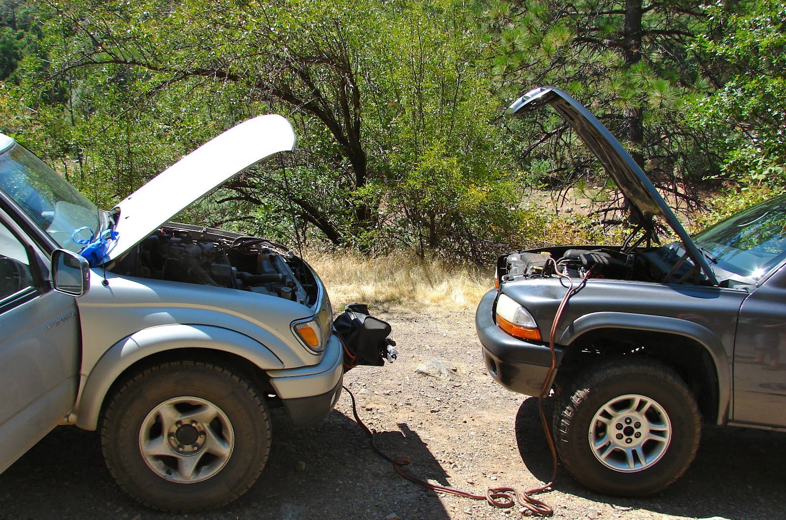
At the McCloud Bridge we met a young man named Josh who, with his wife, was stranded on this remote road with a dead battery. I was surprised to find someone without jumper cables so far off the beaten path until a man and his son walked up and told me a story about an amazing rescue that had just been concluded. The man and his son had been kayaking on the McCloud Arm of Shasta Lake and had come ashore to explore an old mining camp.
While exploring the camp the son fell into a 20 foot deep shaft. The father seeing Josh's truck ran to the road for help. They gathered all the rope from the kayaks, tied them together but did not have enough length to reach the boy without falling in themselves.
After a moment of thought Josh walked back to his truck grabbed his jumper cables, split them in half and tied them onto the rope. They now had enough length to reach the boy without falling in themselves. The son was pulled from the shaft with only scratches, a ripped fingernail and torn t-shirt. In the excitement of rescue the rope and jumper cables slid down into the shaft. No one was too concerned about losing the equipment until Josh went to start his truck ten minutes later. About 20 minutes after that I arrived and heard the story.
(None of the participants wanted to have their photo taken.)
We drove on toward Monday Flat. One of several bridges across Salt Creek.
Another bridge across Salt Creek. The vegetation was very lush along the stream bed.
While making our way to Monday Flat we saw the red letters BH painted on trees at every intersection with an arrow pointing the way. We decided to follow the arrows to BH.
BH turned out to be the site of Bully Hill mine and smelter. We did not drive around the sign although there was evidence that many had done so. Being one who likes to visit historical sites it was hard to resist.
We walked down a short ungated side road to these ruins.
The remains of these two vehicles rested in a shallow pit.
More ruins. A Google search satisfied my curiosity about Bully Hill when I returned home.
Our quest for BH caused us to drive past our original destination so we doubled back. Shortly after our arrival at Monday Flat a forest service patrol boat landed near our position. I was out of the truck taking photographs but jumped back in and drove over to the officers to say hello. After offering them a cold beverage from our refrigerator they offered to write me a citation for not wearing my seat belt during the 100 yard drive over to their location.
Sunset at Monday Flat.
Another deep water camp with a Four Wheel Camper.
The next morning the honking of a flock Canadian Geese woke us from our slumber.
Finding our way back through all the intersections to County Road 27 was simple, we just looked for the red BH arrows and reversed the direction.
At one intersection my passenger had a difficult time locating the red BH. She scanned the area for about 30 seconds and pronounced that there were no markings at this intersection. I asked her if she was certain, whereupon she emphatically stated that we should drive on because there were no red BH's anywhere in sight. My passenger than asked why I was taking a photograph. A second later the fog lifted and we continued on our way.
Crossing Squaw Creek just north of Chirpchatter Campground.
The drive south to Highway 299 was long and curvy and honestly, after a while, a little boring. We crossed the Pit River on a high bridge near the afterbay weir for Pit River Dam #7 and reached the 299 about 20 minutes later.
Impressive action at the spillway.
It was time to head for home.


Like your campfire app, might have to get that for my iPad. My husband was in awe but not surprised over the officer offering to give you a citation, did he give you one or did you manage to get out of it? Amazing.
ReplyDeleteOnce in Death Valley we all sat around a flickering candle, so the app is a better option. The officer, who was young, after a few moments just gave us a warning. He also warned us that our winch was covering the front license plate. That was interesting because several years ago, outside of a Dennys, a law enforcement officer spent a couple minutes talking with me about our winch mount. He wanted to know how to build one and never once said anything about the plate. Cheers.
DeleteYou guys were so close to some really amazing spots around Squaw Creek. Since you didn't mention these places I thought I might point out some of my favorite places and things to do there, just in case you (or anyone) makes it there again. I've been visiting Squaw Creek since the mid-seventies.
ReplyDelete-best time to go
second two weeks of July through first couple
weeks of Aug. or a week or two AFTER labor day.
-Garden of Eden: exactly three miles north (don't go over the bridge) of chirp-chatter the road curves tightly to the right - there is a wide pull-out. Park there, take your air mattress, sun block and snorkel (your favorite libation will be much appreciated in a couple of hours). Walk down the STEEP hill (there is only one sensible way down. If this is your first time there, when you get to the creek, walk left about 50 yards - careful! you will be standing on top of a 10 foot tall waterfall. Look at the pool downstream from the waterfall.
You're not going there, but the spot you want to go is just downstream from there. However you can't get there from where you are. Walk back upstream about 50 yards (the more the better). Cross the stream, don't fall in unless you enjoy going over waterfalls. You need to go up those steep rocks ahead of you. Fallow the path to the left until see a smaller creek (north branch of Squaw or Little-Squaw) cross it. NOW you can walk to the left down to THE SPOT. The Garden Of Eden.
- Potem Falls: Do this as a last stop on your way back to hwy. 299. You probably won't see a sign - the locals pull it down faster than the forestry service can put it back up. After leaving squaw creek you will wind your way up and then down a mountain. When the road flattens out for a while keep looking to the right for a creek (Potem Creek). When you no longer see (or hear) the creek look for a left hand curve with a small turnout. Park there. you will need a FAST air mattress (surf mats work well) and a towel. Walk down the path to Potem Falls. It's about 150-200 ft. tall.
Here is what you need to do. Inflate your air mattress until it's hard. put it in the water and inflate it some more. Do not attempt to 'get used to the water' It's snwomelt, you can't. Don't delay and don't think about it. Take off all your clothes(optional but highly recommended). Launch yourself toward the falls - yes, it's loud and the wind from the falls is intense. Go AROUND the falls and enter the cove behind. Place your feet on the wall of the cove and push off. Aim directly at the most dense part of the waterfall - paddle hard - Don't think! Once you start to go under the falls the air mattress will sound like a jet engine - you will feel like you just fell off a 30' wave - KEEP PADDLING. When you exit the falls the wind will push you back to shore. Get out of that cold water. You are now the proud owner of 'bragging rights'. You are entitled to call anyone with you a chicken if they don't do it also. You will feel alive and refreshed.
I'm tired of typing for now. there's a whole bunch more to tell. I will if someone asks.
Hello Chris,
DeleteThank you for the information. We did not know about the Garden of Eden. Sounds like a cool place. Potem Falls we did know about and you are correct there was no sign. We stopped but decided not to hike down the trail to the falls. It was afternoon and we had a long drive ahead of us. The next time we are planning to visit the area I will contact you for more information.
Cheers.
Thank you. I grew up in the area and never know about this spot. What an incredible place to swim and enjoy the water. We had a little bear waiting for us back at the top who wanted in our lunch bags so watch for furry friends out there.
DeleteJust browsing thru your Shasta lake aventure specifically Monday flat. The houses youpast above the flats are houses my family , myself built lived in for a very long time. There's alot x there and bh you probably missed. I recommend returning for another round. Thanks for sharing.
ReplyDelete