We drove NE from Tonopah on the Gabbs Pole Line Road passing the controversial Crescent Dunes Solar Energy Project.
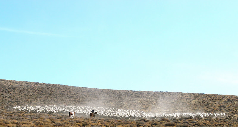
When driving to the site of Pactolus we passed a shepherd's camp and later saw him high on a ridge with his herd.
Sunset at Pactolus camp. Not much here to see. We did not find the lone building reported at this site.
Jan silhouetted by a Nevada sunset.
The next morning when driving west toward Simon we notice that the shepherd started his day much earlier than we started ours.
Climbing a ridge on the approach to Simon Mountain.
Hiked to the summit of Simon Mountain and rebuilt the marker.
Entering Simon. There are over 25,000 feet of underground workings at Simon, some more than 1000 feet deep.
Note the two different building styles of this structure.
The sun silhouettes an old ore bin.
Rawhide Ranch. Jan really wanted to meet
Rowdy Yates but no one was home.
Finger Rock looms over our truck.
Jan zooms the camera in on me as I look down from the top of Finger Rock. The route to the top was easier than it looked.
If cows could talk this one might explain how it all happened.
Exploring mining roads west of Rhyolite Pass.
The sun begins to set as we look for a place to camp.
Sunrise at our west of Rhyolite Pass camp.
Driving down to Rhyolite Pass.
On our way to the Blue Sphinx.
We spot our objective.
Getting closer.
It must have been quite a surprise for a prospector roaming these mountains to encounter the Blue Sphinx.
We drove around the mine camp but only found this small dugout and the usual adits and shafts. On a ridge to the north we could see a structure at the Golden Pen mine.
We drove down from the Blue Sphinx and turned toward Poinsettia.
Poinsettia. From what I have read it isn't really a ghost town but the remains of a cinnabar (mercury) mine camp.
My favorite structure at Poinsettia was this dugout. A look inside revealed that it was used for storage.
Leaving Poinsettia Camp.
The name on the map read, "Car Frame Windmill." With a name like that you have to visit. The windmill seems to be made out of any odd piece of steel on hand, including at least two car frames and an old military vehicle.
On our way to Rawhide Hot Springs. We drove through about 1/4 mile of deep sand north of Black Butte. Thought about stopping and taking a photo but we didn't bring sand ladders and it wasn't worth the risk of getting stuck.
Rawhide Hot Springs. An incredible amount of junk and debris scattered all around the springs. The springs appear to have been developed sometime in the past.
This is the actual spring and from here the water is routed into two other pools. When I was walking near one of the other pools I startled a duck that was feeding. Was it spending the winter at Rawhide?
Rawhide Wetlands.
More sand east of Fissure Ridge. This time the sand wasn't very deep.
Getting close to Downeyville. Many ruins here but we did not find any standing structures. In the remaining light of the day we decided to drive to Craig Station.
Craig Station in the light of a new day.
Dawn at Craig Station. The temperature dropped to 17º during the night.
Pavement ahead.
Time to fuel up because we don't know if the gas station in Gabbs was still open.
We drove on to Gabbs and the station was as I remembered it.
Sunday, the nearest gas was 60 miles away in Hawthorne and it was time for us to head for home.
Junction with US 395 January 2012.
No snow this year at the intersection. We were surprised by the lack of snow during the entire trip.
Junction with US 395 January 2011.
Looking east January 2012.
Looking east January 2011.
Driving south of June Lake we noticed a volcano in the distance preparing to erupt. ;)


Wow! The adventure you guys have is just amazing! i love that picture of Jan silhouetted by the Nevada sunset. Its beautiful. And that of you on top of that rock. I am sure Jan did not agree to go on top of the rock. and if she did, well hats off! i hope that some day i will make it to some crazy adventure like this.
ReplyDeleteNeomy
American racing Wheels
The sunset on the night that I photographed Jan was spectacular but I waited to long to get my camera and missed the most dramatic light. When we saw Finger Rock looming above the road it looked very imposing but a bit of scouting around revealed an easy route. Thanks for posting.
ReplyDeleteCheers.