
After fueling in Mesquite we drove to Whitney Pockets on the Gold Butte Road.

A CCC dam in a nearby canyon.
Some reports say that the dam built by Luke Whitney in 1886 later refurbished by the CCC. There is a smaller dam higher in the canyon, maybe that is the solution to this conflict.

Another view of the dam.

We visited Devil's Throat, a sinkhole about 100 feet across and 70 feet deep as we drove west to Little Finland.

After exploring a cave Alex spots the pictographs that we had stopped to look for while driving west from Devil's Throat.

The pictographs.

Some of the formations at Little Finland.

You could spend hours here taking photos.
Here is a link to someone that did.

One of several bulls protecting a small herd of cattle.

Our campsite in Mud Canyon about a mile west of New Finland.
During the night one of the bulls became annoyed at our presence.
Around midnight he snorted and trumpeted near our camp for about an hour.
Campers in their tents were a bit concerned but those sleeping in a FWC just returned to their slumber.
The next morning several of the Rubicon passengers attempted to challenge a nearby bull with their voices much to the amusement and concern of the rest of us.

After hiking around Mud Canyon searching for Red Bluff Spring (found it), we headed south down Gold Butte Wash.

The flora changed has we drove up the wash to higher elevations.

Alex found a tub in which to relax.

Not much left at Gold Butte.
One of the mine shafts had water about eight feet below its gate.


“The Odd Pair.”
Bill Garrett, was a tall Texan cowboy and an expert gunman, and the nephew of Pat Garrett, the lawman who shot Billy the Kid. His sidekick was Art Coleman, short and slight, intellectual, and of frail health.
The two men arrived in the Gold Butte area about 1916, and for years, their humble shack was a stopping place for travelers. They were known for their hospitality and for keeping their word. Coleman died in 1958 and Garrett died a few years later. They were both buried at Gold Butte, although ground radar shows their grave markers were interchanged.
Desert Valley Times
David Bly
Friday, January 18, 2008
More about Garrett and Coleman.

We continued west trying to reach the Overton Branch of Lake Mead.
If the lake was higher we could have taken a cool swim but it was so low that the road came up short in reaching the shore. The location in this photo is underwater when the lake elevation is higher.

Returning from our drive down Catclaw Wash

The road back to Gold Butte.

We drove through Gold Butte and headed north.
Then we turned southeast down Black Wash crossing the AZ border while making our way to Grand Wash Bay in another attempt at reaching Lake Mead.

Another bull to amuse the Rubicon passengers.

The road to the lake eventually came to an end on a soft gravel side hill about 1/4 from this photo without seeing the lake. The leading Rubicon pushed on to the end and had a bit of a scramble to make it back to the sand.

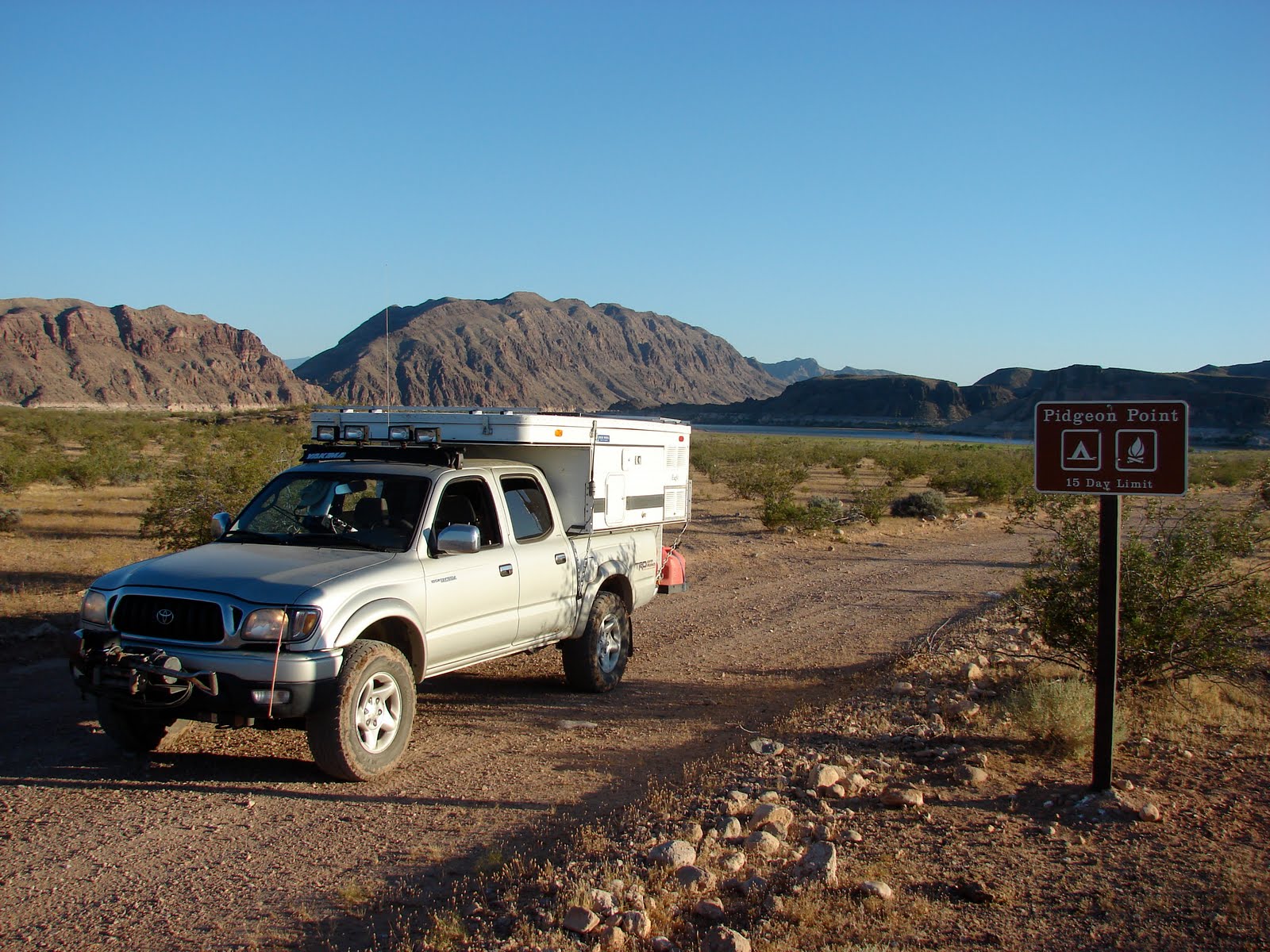
The sign warns that you must limit your stay to 14 days.
We stayed about 45 minutes.

The Tassi Ranch in Pigeon Wash.

We got closer to Lake Mead here at Pigeon Point but there was still about 1/4 mile of mud flats between us and the lake. Alex, not quite understanding the nature of mud flats said he wanted to go for a swim in the lake. The adults made various comments about his mental abilities but encouraged him to follow his inner "Phelps."
He soon learned the nature of mud flats and returned for this photo.
Leaving Pigeon Point with Lake Mead in the background.

The "Box" near Tassi ranch is the mouth of Lower Pigeon Canyon and the western end of the Savanic Mine road. Decision time, Grand Gulch Canyon or Pigeon Canyon.
When I returned from the strip a Google search found this.

This angry rattler was sighted alongside the road as we drove closer to Grand Gulch Canyon.

Camp Two - Neglected to take photo of our camp.

Approaching Grand Gulch Canyon.

Interesting that there was no such sign on the Savanic Mine Road.

Evidence that the sign is correct.

End of the road for us.
ATV riders had widened the road with wood ramps.
I scouted for a bypass and found a difficult one that led to another washout.
Wonder what the Savanic Mine road would have been like.

We headed north to drive Nutter Twist Road up to Hidden Valley.

Approaching Nutter Twist Road.

Climbing up the Hidden Rim on the Nutter Twist Road.

Terry supervises his son refueling their Rubicon while we stop for lunch at Jump Canyon below Hidden Rim and Tweed's Point.

I pick up trash along the roads we travel but here is an example of the gray area between trash and artifact. Designated an artifact.

Dropping down into Hidden Valley.

Following the Rubicons down into Hidden Valley.

Terry and Alex wave farewell as they head for St George and the highway home.


No comments:
Post a Comment