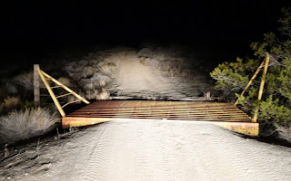
After about an hour of driving on dark desert roads we neared our destination.
Just after this cattle guard we turned left, drove a few more minutes and set up camp.
The game camera recorded a visitor to our camp at 3:46AM
Dawn at our East of the Black Hills/West of NAWS China Lake camp.
Jo Ann's kettle steaming in the brisk morning air.
Panorama of our camp with the Black Hills in the background.
Later in the morning we decided to walk across the desert toward Pilot Knob until we reached the NAWS boundary.
On our way we passed by Tank #3.
Looking south along the NAWS boundary.
During our hike Jo Ann found several WWII .50 caliber cartridge belt links. Video of how the belt links were made and used can be found here.
Off to the West, Owens Peak, center right, could be seen in the distance. Hiked up there twice, the first time in 2001. Jo Ann has been to the summits of both Mount Jenkins, on the left, and Owens Peak.
Eventually we reached camp, prepared lunch and discussed hiking to the Black Hills HP.
Instead we hiked north to the mouth of Black Hills Canyon and discovered an old guzzler.
The shadow of dusk moved across the valley toward Pilot Peak and Granite Mountain as we hiked back to camp.
Night arrives early in the winter.
Pilot Knob silhouetted by the early light of dawn.
Panorama of the area.
Soon it was time to head back to camp.
After breakfast Jo Ann was far from camp sweeping back and forth with a metal detector.
Later in the morning we broke camp and drove North.
A Jeep Rubicon and Pilot Knob.
As we drove West, Mount Langley could been seen to the North. Jo Ann and I hiked to its summit in 2002.
We stopped at Blackwater Well for lunch.
And then continued West toward Cuddeback Lake.
In the distance a cloud of dust told us that vehicles were headed our way.
When they reached the playa the vehicles fanned out into formation before turning North and away from our route.
We continued driving West toward the lake bed.
Panorama of the view to the East.
Crossing Cuddeback Lake.


No comments:
Post a Comment