We drove east looking for a few structures not visited on our last trip to these parts.
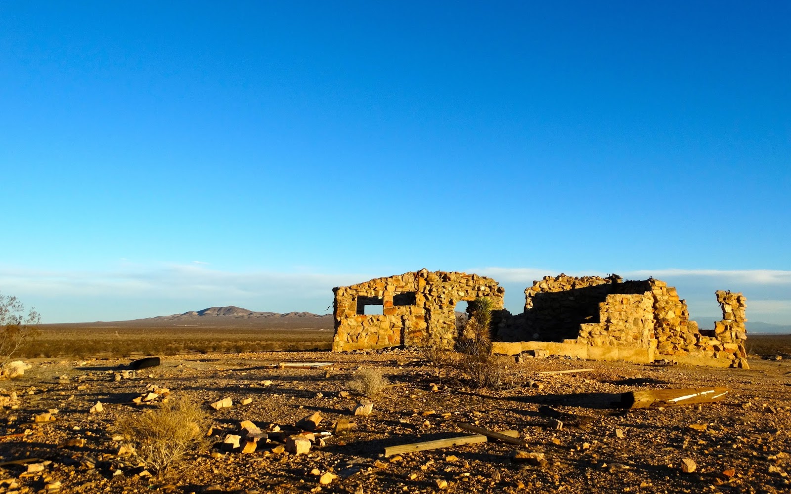
Someone put a lot of work into this rock house.
Would have liked to have visited when the building was intact.
What was at the top of the stairs?
We drove on.
And zigzagged our way to another structure. It was still standing but had been looted.
The second homestead was in the same condition.
The road continued East and so did we.
This rock homestead sat back about 300 yards from the road.
Nothing standing but stone walls.
Two shadows were formed as I climbed on top of a water reservoir to take the photo below.
Many concrete structures at this site.
The shadows were getting long as we motored on to our next stop.
This homestead was built in 1953.
It held at least five rooms and a bathroom with a shower.
Built on a small hill with a rocky butte behind and a tremendous view to the Southwest.
Daylight was hard to find as we drove a narrow road up and over a rocky ridge.
In the darkness along the road were the remains of a camper.
Evidence gathered at the site points to an abandoned Burner vehicle. Burning Man in 2011 and trash in the desert five years later.
We drove on into the night.
A monstrously large Joshua Tree appeared in our headlights.
And we drove on.
We set up camp on a ridge about 50 yards South of the Edwards boundary with the lights of Rosamond in the distance to the West.
Looked like the temperature was below freezing when we set up camp.
Dawn.
Bosco and I went on a hike and found artifacts like this old claim marker.
And a few old cans that predated pull tops. That means they must be more than 50 years old.
Our campsite on the ridge.
After breakfast we drove a sandy wash to the next structures.
There were several buildings at this location. This one had been redecorated by some long range designers.
Bosco inspected an old dog house.
And I found an old steel toed boot. I remember how cold my toes felt working with boots like these during the winter at a coal mine in Wyoming.
On the route to the next structure I sighted something off to the North.
An invitation to shred.
This skateboarding site is far from any paved road but a nifty use of an old foundation.
We were headed for a structure nestled on the saddle of Red Buttes West.
After driving through the remains of the gateway we climbed up a steep rocky road.
For years I had driven US 395 past this structure on my way to other places and always wanted to have the time to check it out.
What a view from the front windows.
A unique building but I have no idea why it was built.
US 395 ahead and time to head for home.


Nice work on your blog. I live in the High Desert and am a lifelong Jeeper/Explorer. I'd like to get some more information from you on the location of the Skatepark and Homestead Ruins so that I can take the family on a day run in this area. Can you PM me the rough location. I would prefer to keep it on the down low so that the world does not find out about and ruin these gems in the desert. If you could text me, that would be much appreciated. 760-490-4849
ReplyDeleteRick
Hello Rick,
DeleteSend me an email using the link in my profile and I will provide the GPS coordinates.
Cheers.
Hey Mr. Johnson thanks for the pictures on top of the Red Buttes... I have been searching all over the internet thinking that round structure at the top of the hill. I though it had to do with Edwards AFB the backside of the Buttes butt up against Ewards AFB boundry line do they got fencing on the backside of the mountain (north side), have you seen it? Great pictures by the way!
ReplyDelete