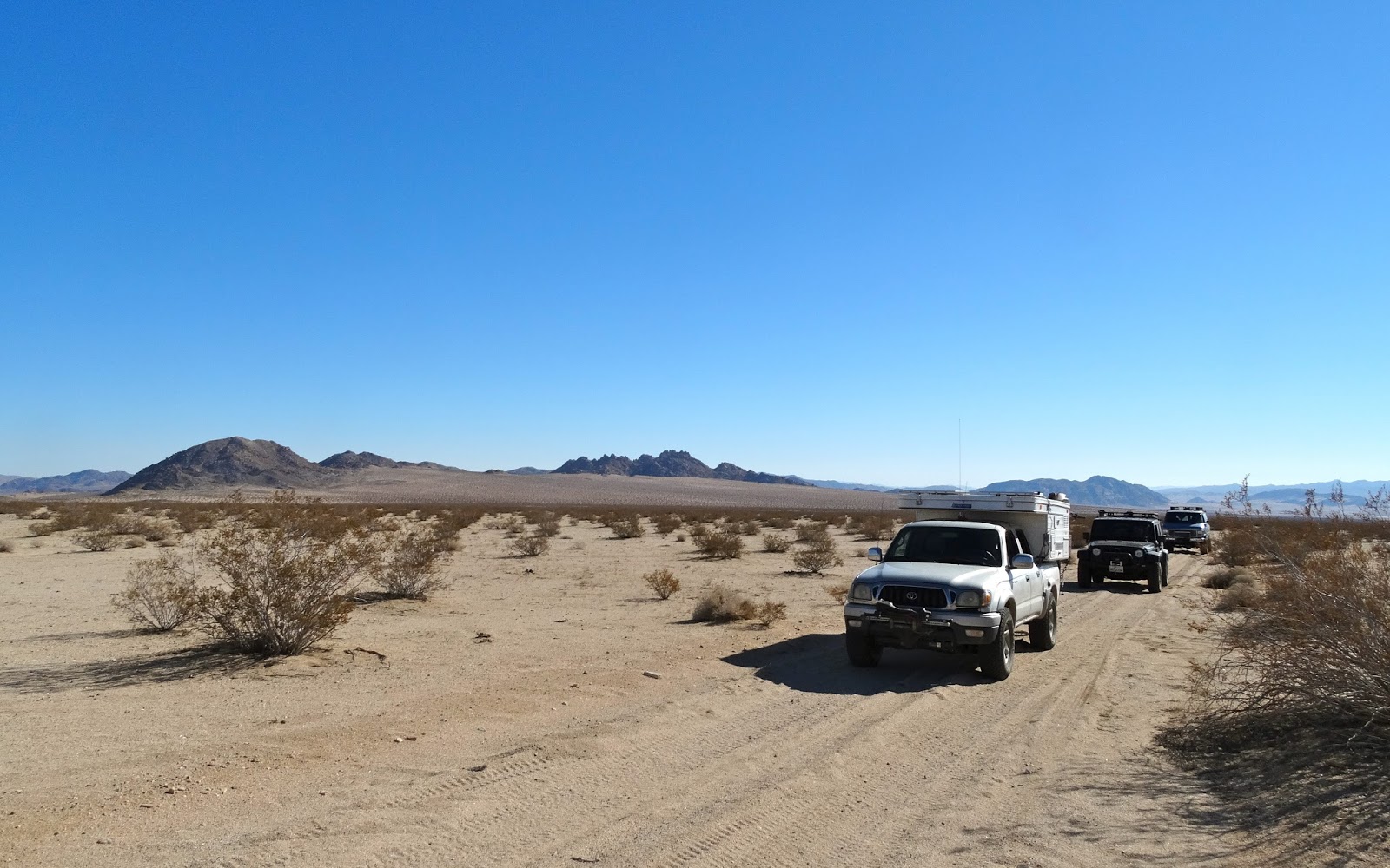
We rendezvoused at the Walmart in Barstow.
Then drove East and found the northern ingress(ingressus) of Box Canyon Road.
Soon we were in a forest of Smoke Trees.
We continue south and soon arrived at
the Box Canyon narrows.
Along our route we stopped several times to explore side canyons on foot.
The road turned sandy as we reached the egress(
ēgressus)* of Box Canyon.
*Dear readers, that will be the last time Latin is used in this post. I informed Bill that people don't need to suffer because he studied Latin in college and enjoys words that have roots in that language. If you ever have difficulty falling asleep ask him to explain Future Perfect Tense. - Jan
After crossing under power-lines we drove south on the old Bessemer Mine Road toward Johnson Valley.
Shadows were long as we set up camp.
The evening temperature was cold, with an over night low of 19º, but we managed to sit outside talking and gazing at the stars much longer than expected. Would have been a great location for watching a meteor shower but only two were observed.
A fox prowled around our camp at 1:27AM and returned at 2AM.
The game camera also photographed a ghostly creature named Daisy just before 5AM.
Dawn illuminated a frosty camp.
Soon the rays of the rising sun began to warm things up as we ate breakfast and prepared to break camp.
It doesn't look like much but we are parked on a surface rupture associated with the 1992 Landers earthquake along the Emerson fault zone. Not much remains today except a barely noticeable road displacement and a slight bump in the road.
What the rupture looked like in 1992. (photo credit and info:
http://geomechanics.geol.pdx.edu)
Jo Ann found one of several survey points used to measure ground movement.
A closer look.
We drove on to our next destination. About 45 minutes into this drive I realized that we should have continued East to visit a second item near Galway Lake. That item will now be included in the next trip to this area.
There are occasions when a desert traveler finds something that requires answers to the questions of, "Why?" or "How?" This was one of those times.
We drove on.
Burro or cattle track? Red Hill in the background.
Mike and Jo Ann spotted this cabin in a distant canyon so we drove up to take a look. This collapsed cabin and the tanks in the distance are all that remains of the Copper Strand Mine. After looking at this cabin for a few minutes I recalled being there 14 years ago with my friend Al in his lifted tricked out Jeep Cherokee. The next month Al and I had quite an adventure when his drive shaft broke on the John Bull Trail up in the San Bernardino Mountains.
Mike in the Big Blue Van drove over this rock but me in my little silver Tacoma had to drive around.
We drove the wash route North.
Until we left the wash and joined the old Camp Rock Road.
As we neared Camp Rock we turned right on OJ228/Cinder Mine Road and after driving a couple of miles the mine came into view.
Just before the mine we turned right, drove a couple of miles, quickly parked our vehicles, grabbed our daypacks and hiked SE toward Surprise Tank.
Many photographs were taken when we reached the tank.
Here are some of my favorites.
No water in the tank.
The sun had set by the time we got back to camp. Once again we sat out eating dinner, watching the stars and talking until the below freezing temperatures encouraged us to move inside our vehicles and sleeping bags.
In the cold morning air after an 18º night, we prepared to hike to another tank that was much farther away.
Even more photo opportunities at this location.
Although the subject matter appeared older and a bit faded compared to the day before but it could have been the difference in light, late afternoon versus morning.
We hiked on, exploring deeper into the lava field.
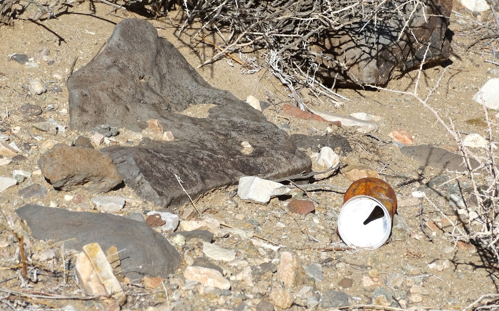
In 2015 this can could be a true historical artifact because pull-tabs were introduced in 1965.
We eventually reached a canyon that was about 200 feet deep.
After discussing how to reach the valley below we decided to return to camp but placed this canyon on our "to-visit-later" list.
We broke camp and drove West on the new Camp Rock road toward Lucerne Valley and then went our separate ways for home.


No comments:
Post a Comment